Vancouver Island is laced with streams, wetlands, and sensitive ecosystems. If your property is near a watercourse, has a history of commercial or industrial use, or falls within a designated environmental Development Permit Area, you'll need a Qualified Environmental Professional (QEP) before your development can proceed. Their assessments can significantly reshape what you can build and where — making early engagement critical. The environmental consultant is one of ten key professionals covered in our development consultants guide for BC.
QEP Designation in BC: Who Qualifies?
"Qualified Environmental Professional" is a regulatory term in BC, not a single credential. A QEP is a professional who meets specific education and experience requirements to conduct environmental assessments under BC's Riparian Areas Protection Regulation and other provincial legislation. QEPs typically hold one of the following designations:
- Registered Professional Biologist (RPBio): Registered with the College of Applied Biology of BC (CAB-BC). RPBios are the most common QEP designation for riparian and species-at-risk assessments
- Professional Agrologist (PAg): Registered with the BC Institute of Agrologists. PAgs may qualify as QEPs for certain environmental assessments, particularly those involving soil and agricultural land
- Professional Geoscientist (P.Geo.): Registered with EGBC. P.Geos with environmental specialization are common QEPs for contaminated sites assessments
The distinction between these designations matters because different types of environmental assessments require different expertise. A RAR assessment near a salmon-bearing stream requires biological expertise (RPBio), while a contaminated sites investigation requires geoscience expertise (P.Geo.).
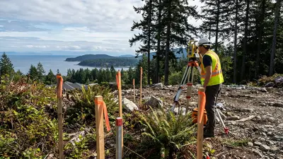
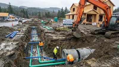
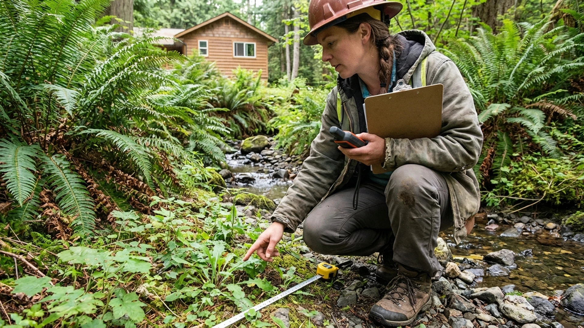
A Qualified Environmental Professional conducting a stream assessment near a development site, evaluating water quality and habitat conditions.
Riparian Area Regulations (RAR): The Most Common Trigger
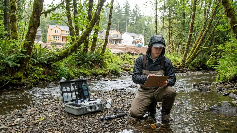
The BC Riparian Areas Protection Regulation is the environmental regulation most frequently encountered by property owners developing on Vancouver Island. RAR applies to development within 30 metres of any stream, creek, river, or watercourse — and Vancouver Island has an extensive network of these flowing through residential areas.
Many property owners are surprised to discover that a seasonal drainage ditch or a small creek at the back of their lot triggers RAR assessment requirements. Even watercourses that appear insignificant may be classified as fish-bearing or fish-capable under the regulation, triggering full assessment requirements.
Streamside Protection and Enhancement Areas (SPEAs)
The RAR assessment determines the Streamside Protection and Enhancement Area (SPEA) — a setback from the watercourse where development is restricted. The SPEA is established by the QEP based on the watercourse characteristics, riparian vegetation, fish habitat value, and other ecological factors.
SPEAs can range from 5 metres to 30 metres or more from the high-water mark of the watercourse. For properties on smaller urban lots, a 15-metre SPEA from a rear creek can consume a significant portion of the developable area. This is precisely why RAR assessment should be done early — before you invest in architectural design for a building footprint that may not fit. Our development potential assessment guide can help you identify potential environmental constraints early in the process.
Species at Risk on Vancouver Island
Vancouver Island supports several species and ecosystems at risk that can affect development projects:
Garry Oak Ecosystems
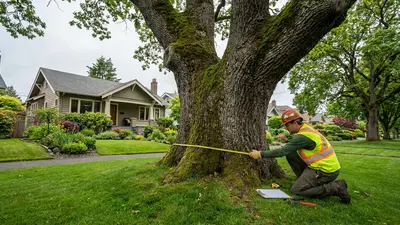
Garry Oak ecosystems are among the most endangered in Canada, and they are concentrated in the Greater Victoria area. These ecosystems support a unique assemblage of plants and animals found nowhere else in Canada. Development within or adjacent to Garry Oak habitat may trigger additional environmental review and mitigation requirements.
While the arborist addresses individual Garry Oak trees, the QEP assesses the broader ecosystem context.
Great Blue Heron Nesting
The Pacific Great Blue Heron (subspecies fannini) is a species of special concern in BC. Heronries — nesting colonies — are found across Vancouver Island, including in urban areas. Development near an active heronry triggers assessment requirements and may impose seasonal construction restrictions.
No disturbance activities are permitted within a specified buffer zone during nesting season, typically February through August.
Contaminated Sites Assessments
When land is rezoned from commercial or industrial use to residential, BC's Contaminated Sites Regulation (CSR) triggers a formal assessment process:
- Stage 1 Preliminary Site Investigation (PSI): A desktop review of the property's history, land use records, regulatory databases, and aerial photographs to identify potential sources of contamination. The Stage 1 PSI determines whether a more detailed investigation is warranted
- Stage 2 Detailed Site Investigation (DSI): Physical investigation involving soil sampling, groundwater monitoring, and laboratory analysis to determine whether contamination is present and at what concentrations. If contamination exceeds regulatory standards, remediation or risk management measures are required before residential development can proceed
On Vancouver Island, contaminated sites assessments are most commonly associated with former gas stations, automotive repair shops, dry cleaners, printing operations, and light industrial uses. Properties in Victoria's older commercial areas, near harbours, and in established industrial zones may require assessment when being converted to residential use.
Environmental Management Act Compliance
BC's Environmental Management Act provides the overarching framework for environmental protection, including contaminated sites management, waste management, and environmental impact assessment. For development projects, compliance typically involves demonstrating that the project will not cause contamination, will properly manage stormwater quality, and will not adversely affect environmental resources.
When Are Environmental Assessments Triggered?
- Rezoning near watercourses: Any rezoning application for property within 30 metres of a stream triggers RAR assessment
- Former commercial or industrial land: Rezoning from commercial or industrial to residential triggers contaminated sites assessment under CSR
- Development Permit Areas: Properties within environmental DPAs require environmental assessment as part of the Development Permit process
- Subdivision near environmental features: Creating new lots near watercourses, wetlands, or sensitive habitats triggers environmental review
- Municipal referral: Even when not strictly required by regulation, municipalities may refer development applications to environmental review if they identify potential environmental concerns
QEP vs. Arborist: Understanding the Difference
Property owners sometimes confuse the roles of the environmental consultant and the arborist. While both deal with the natural environment, their scopes are quite different:
- Arborist: Focuses on individual trees: species identification, health assessment, protection planning, and removal permitting. Works under municipal tree protection bylaws
- Environmental consultant (QEP): Assesses broader environmental systems: watercourses, ecosystems, contamination, species at risk, and habitat. Works under provincial and federal environmental legislation
A property near a creek with protected trees on it needs both professionals. The arborist addresses the trees under the municipal bylaw; the QEP addresses the watercourse under RAR and the broader ecosystem considerations. Their work overlaps but is not interchangeable.
Typical Costs on Vancouver Island
| Assessment Type | Typical Cost Range |
|---|---|
| RAR assessment | $2,000–$5,000 |
| Species-at-risk assessment | $3,000–$8,000 |
| Stage 1 PSI (contaminated sites) | $3,000–$6,000 |
| Stage 2 DSI (contaminated sites) | $10,000–$30,000+ |
| Environmental monitoring (per visit) | $500–$1,000 |
RAR assessments are relatively standardized in scope and cost. Contaminated sites investigations, particularly Stage 2 DSIs, vary enormously depending on the type and extent of contamination, number of monitoring wells required, and laboratory analysis needed. Stage 2 costs can escalate significantly if contamination is widespread.
How to Choose an Environmental Consultant
- Verify QEP qualifications: Confirm RPBio registration through the College of Applied Biology, or P.Geo. registration through EGBC, depending on the assessment type needed
- Assessment-specific experience: Choose a consultant experienced with the specific assessment you need; RAR, contaminated sites, and species-at-risk assessments each require different expertise
- Vancouver Island knowledge: Local knowledge of watercourses, species distributions, and municipal referral processes significantly affects the quality and efficiency of the assessment
- Regulatory relationships: An experienced consultant will have established relationships with provincial regulators (BC Ministry of Environment) and understand how to navigate the approval process efficiently
Check Your Property's Development Potential
Environmental constraints can significantly affect development feasibility. Our free Development Potential Assessment helps identify potential environmental triggers on your Vancouver Island property.
Start Your AssessmentThe Complete Consultant Guide Series
- Overview: Building Your Development Team
- Part 1: BC Land Surveyor (BCLS)
- Part 2: Certified Arborist
- Part 3: Geotechnical Engineer
- Part 4: Building Architect (AIBC)
- Part 5: Structural Engineer
- Part 6: Civil Engineer
- Part 7: Building Envelope Consultant + Energy Advisor
- Part 8: Landscape Architect (BCSLA)
- Part 9: Environmental Consultant (QEP) — You Are Here
- Part 10: Traffic Engineer
Disclaimer: This article provides general information about environmental consulting for development in BC as of February 2026. Environmental regulations are complex and change frequently. Always confirm specific requirements with your local planning department, the BC Ministry of Environment, and qualified environmental professionals. This is not legal or professional advice.